
Sat, Jun 8 2013 - SLOWPOKE HIKE: Beautiful Hockley Valley (13 km) (View Original Event Details)
|  |
A great group of sixteen headed off to Hockley Valley on June 8, 2013. Despite gloomy grey clouds overhead, we didn’t have a single person who was a no-show. Great attitudes, everyone!
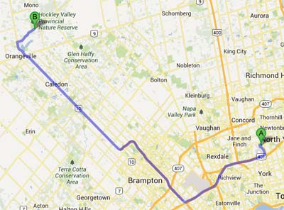
It took about an hour to drive to the parking lot. We arrived there to find the second TOC group who was doing the trail that day, led by Linda. We hiked in a clockwise direction, first taking the Main Bruce Trail loop, then the Snell Loop, then the Glen Cross ST and Isabel East Side Trail (which on maps looks like second half of Glen Cross ST but was apparently recently renamed), then Tom East Side Trail back to the parking lot.
I had billed this as a “SLOWPOKE” hike but when we crunched our average moving pace at the end, we were definitely going a little faster than I had planned – our average hiking speed was 4.1 km/h. I had expected to go between 3 and 4 km/h for this trail, which has intermediate terrain. Hockley Valley is renowned for its many hills, constantly climbing escarpment ridges and then dipping down to the bottom of steep valleys to cross bridges over streams. Congratulations to everyone for doing it - it was a challenge!
Next time on a slowpoke hike, I might make sure we smell a few more roses … or in this case, pause to check out the foot-long fish in the stream (good eye, Jo-Ann!), the tiny orange salamanders (ditto, Vimal!), the ruins (likewise, John) and more.
We also hiked a bit longer than planned, although we were feeling good as a group. Our total distance was 15 km. (On a future slowpoke hike, depending on the group, I might suggest dropping a loop on this one to shorten it to 12-13 km.)
But it was a beautiful hike through lovely woods and along bridges over picturesque streams. In fact, several people mentioned they liked it even more than recent trips to Mono Cliffs, etc., because it was more like an adventure challenge – climbing over styles on fences, up and down stairs on the slopes, over bridges, etc. It was like the Amazing Race. Only four hours long. And slower. And no prize at the end. So really not that much like the Amazing Race…. But fun anyway!
Lucky for us, the rain threatened but held off and it was actually a lovely coolish temperature, just right for hiking! The clay of the trail was a bit slippery as it was on the downhills – I was glad to have my new hiking poles. I can imagine some sections would be challengingly slick in a rain storm.
In fact, the sun broke out for our lunch break about halfway along the trail, where it widens into a cleared field by a water reservoir. Some even lay back to soak up a few rays.
When we finished, some of us had to return directly to the city at the end, while others stopped at the Kelseys restaurant along Highway 10 in Orangeville for an early dinner (and well-earned beer/cider/pop/water).
A big thanks to our drivers – Hanna, Andrea, Kim, Norman and Vimal! Thanks so much, folks. We could not have done this trip without you.
Thanks to Vimal, Alex, Julianne and others who took turns leading while I got to bop around visiting with everyone. And thanks to Tahereh and Kim for taking turns as sweep. (Apologies if I’ve missed someone here.)
Finally, thanks to Colin for tracking our progress on his GPS that I envy and wish I owned....
All in all, a great hike.
Have some photos from this event that you'd like to share in our photo album? Please forward them to Erik Sonstenes at photos@torontooutdoorclub.com. Please note that we prefer to receive the photos in approximately 640x480 or 750x500 pixels - do NOT send original high-res photos. If you have a LOT of photos, please submit up to twenty of your favorites (only) for a day event, or up to forty of your favourites for a multi-day event. Thank you.