
 Print-Friendly Version
 Pour toutes informations en français, s'il vous plaît contactez Jenn ŕ francais@torontooutdoorclub.com.
Jokers Hill Conservation Area 15 km (1/23/2016)
PRE-REGISTRATION REQUIRED: Once you've reviewed the event details, and decided you'd like to join us, you MUST sign up at the bottom of this page.You are STRONGLY encouraged to read this page in its entirety before signing up. If you'd like to attend, we ask that you abide by our rules and procedures as a time/cost saving process (with an end result of keeping membership free and lower cost events).
| The Basics: |
| ||||||
| Event Type: | Hike | ||||||
| Event Location: | Jokers Hill Conservation Area, Newmarket | ||||||
| Date(s) & Time: | Sat, Jan 23 2016 11:00 AM (Carpool Departure: 10:05 AM *log in for location*) | ||||||
| Registration Cut Off: | Fri, Jan 22 2016 11:00:00 AM | ||||||
| Event Duration: | 3 to 4 hours of hiking | ||||||
| Difficulty Rating: | D3: Moderate | ||||||
| Event Coordinator(s): |
Arnie
You must be logged in to get the Event Coordinator contact information. | ||||||
| Member Cost: | Voluntary Donation Only (See Below) | ||||||
| Participant Info: | |||||||
| Who's Invited: | Members Only, 18 And Older Only | ||||||
| Maximum Group Size: | 4 | ||||||
| Minimum Group Size: | 3 | ||||||
| Number Registered So Far: | 15 (To see who's signed up, log in to the Member Area) | ||||||
| Are Dogs Permitted: | No | ||||||
| Itinerary: | |||||||
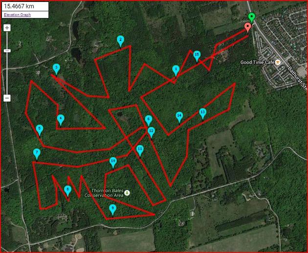
DISTANCE: about 15 km PACE: about 5 km/h DIFFICULTY: D3.5 (because of the hills) You MUST have Icers /
Traction Devices with you on this hike.
I came across these 2 great little connected
conservation areas in Newmarket, Jokers Hill
Conservation Area and Thornton Bales Conservation
Area.
The map above does not actually show our route
or approximate route.
MAX hikers: about 15 (+ or -)
Members on the waiting list who are willing
to drive will get first priority.
DRIVERS, WHEN YOU SIGN
UP, PLEASE ANSWER THE CARPOOL QUESTION REGARDING
THE # OF PASSENGERS YOU CAN TAKE IN YOUR CAR!!!
For an interactive Route Map, of the map at
the top of this page
| |||||||
| |||||||
| How to Get There: | |||||||
| Event Directions: | Carpooling? Please arrive before the departure time. If you are late, you will miss the carpool, and you will miss the hike. If you choose to meet at the event, please arrive on time, we will not wait for late comers.
MAP SHOWING THE HIKE START LOCATION
ENTRANCE TO PARKING LOT
| ||||||
| Carpool to Event Distance (round trip): | 104Km | ||||||
| Carpool Departure Time: | 10:05 AM | ||||||
| Carpool Location: | Log in for location | ||||||
| Carpool Directions: | Log in for directions | ||||||
| Carpool Cost: | Approximate vehicle expense for this event is $26.83 (calculated at total Km * $0.258, effective Sunday, April 28, 2024). This is based on $0.08/Km for maintenance, plus current gas price divide by 9. Your event coordinator will confirm exactly how much money is required from each person. | ||||||
| Notes: | |||||||
|
Carpooling? Please arrive before the departure time. If you are late, you will miss the carpool, and you will miss the hike. If you choose to meet at the event, please arrive on time, we will not wait for late comers. This hike will go forth snow, rain or shine Earthquakes, tsunamis, volcanic eruptions, tornadoes, general discombobulation and hurricanes may cause cancellation Please arrive before the start time, we will start promptly. - We encourage all members to follow our Etiquette Guidelines at all times while participating in TOC events. - Details of this event are subject to undergo a change at any point in time, with or without warning. - Questions about equipment or rentals? Send them to safety@torontooutdoorclub.com. - Notice any errors or problems in the information on this page? Please notify our Content Editor(s), Stacy, at content@torontooutdoorclub.com. | |||||||
| Voluntary Donation: ( What is this?) Suggested donation amount for this event is: $2.00/Person. | |||||||
Cancellation/Partial Attendance: Please review our Cancellation Policy carefully! | |||||||