
Sun, Jun 17 2012 - Mono Cliffs Provincial Park (16 km 4.0 k/h) (View Original Event Details)
|  |
We lucked out on this hike to Mono Cliffs Provincial Park, just northeast of Orangeville. Although the weather predictions ranged from smoking hot to thunderstorms, we trekked along on a largely pleasantly overcast day, a bearable 27 degrees with no rain and – best of all – no bugs!
For those who care about the route there: We met at Downsview subway station and took a relatively straight-forward path: Hwy. 401 west, then 400 north, then west again on Hwy. 9, a pause to regroup at the Tim Hortons in the small community of Mono Mills, then north on Airport Road/ County Road 18 and west onto Mono Centre Road/County Road 8. Finally, as the road began to arc south, we turned right onto 3rd Line E. A minute or two more, and we were at the parking lot turnoff. One carful of hikers was so excited that they shot right past the turnoff on Hwy. 400 but took an ingenious series of detours to meet us, including dodging fire trucks blocking country roads. When we got to the lot, we were glad to have a roll of loonies with us. Turns out the parking machine costs $11, in loonies, toonies or quarters – but the machine won’t take new loonies or toonies, be forewarned!
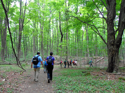
The trail started with a gentle climb heading west on the Carriage Trail with a border of woods and a large and sunny field. After about 10 minutes we turned left onto the Southern Outlier Loop. Soon we were zigzagging up the longest and steepest climb of the day, climbing between massive boulders to the top of the outlier ridge. Then we caught our breath while strolling through a gorgeous hardwood forest – occasionally opening up to some very good views across the valley.
We strolled right past the turnoff onto the main Bruce Trail at first, so did the full Outlier Loop back to the Carriage Trail turnoff then retraced our steps to the intersection – good thing it was largely flat! By that point, stomachs were rumbling so we stopped for lunch in the not-exactly-wilderness-but-sun-drenched remnants of an old parking lot. Clearly an enchanted one because it seemed only a half-hour had passed when Caroline – who was mentoring Christine on her first trip as a volunteer -- started dropping hints that it was time to move on. Apparently more than an hour had gone by as we chatted and dozed in the sun. Some people grew beards….
We carried on along the Bruce Trail itself, passing a few people fishing at two scenic and large ponds complete with benches– a decent spot to break for lunch on another trip. Then we climbed a somewhat rocky trail through the woods and meadows full of tall shrubs, grasses and raspberry bushes. Eventually we headed back into a woodier area and onto a gravel road, before branching off onto McCarston’s Lake Trail. Again, we came to a few lookouts with great views including the lake itself (note to self: another good lunch spot) before looping back down to the main Bruce Trail.
Here we made the happy decision to clamber down a few stairs marked on the map. To our delight, the metal steps lead to a fantastic fissure in the rock known as Jacob’s Ladder. As we passed along a wooden boardwalk between two huge slabs of moss-covered rock, we could see white cedars said to be up to 700 years old as well as rare ferns and mosses. Apparently if you look carefully and have a little luck, you can also see the fossils of creatures that lived when this rock was sea bottom about 400 million years ago. Definitely a high point on the trip!
We climbed back up the stairs and continued south along the trail for a few more minutes to a metal lookout with a great view, then backtracked to the previous intersection.
We skipped the Lookout Trail Loop as it was getting late in the day, instead taking a series of short sections of various trails to skip back to the parking lot.
Then we broke into two groups, once of which headed straight back to town and showers. The others took their smelly bodies to a very nice Moxies Bar & Grill off Hwy. 400 at Vaughn Mills, for dinner.
In total, we hiked 14.5 km at a pace of about 4.3 km/hr, with a lunch break of an hour or so. Total time on the trail, including breaks, was 4 hours and 40 minutes.
Have some photos from this event that you'd like to share in our photo album? Please forward them to Erik Sonstenes at photos@torontooutdoorclub.com. Please note that we prefer to receive the photos in approximately 640x480 or 750x500 pixels - do NOT send original high-res photos. If you have a LOT of photos, please submit up to twenty of your favorites (only) for a day event, or up to forty of your favourites for a multi-day event. Thank you.